FogCast · Badlands National Park, SD
Fog Forecast for Badlands NP
Know before you drive: FogCast checks the conditions that produce photogenic fog
Reading current conditions…
Photography Forecasts for Any Location Worldwide
Fog photography at Badlands National Park
The Badlands are an eroded landscape of pinnacles, spires, buttes, and canyons carved from soft sedimentary rock on the South Dakota high plains — a terrain almost without parallel in North America. Fog is not a daily occurrence here the way it is in wetter mountain environments, but when radiation fog or low fog from storm systems does form over the Badlands, the effect is exceptional. The pale banded spires emerge from white mist, the layered geology disappears into grey at the horizon, and the usual arid harshness of the landscape is replaced by something ghostly and surreal.
The overlooks along Badlands Loop Road — Pinnacles Overlook, Big Badlands Overlook, and Yellow Mounds Overlook — are the best positions for fog photography. When fog fills the lowland basins between the buttes, the higher formations emerge above it. Fog in the Badlands is rare enough that any significant event is worth pursuing. Late autumn and early spring, when temperature swings are sharpest and moisture from weather systems can combine with cold nights, produce the most likely fog events. Summer thunderstorm remnants occasionally leave fog in the basins overnight.
Badlands fog is most likely following frontal passages when residual moisture combines with a sharp overnight temperature drop and calm winds. The flat high-plains terrain around the park allows fog to form over a wide area and then settle into the lower badlands topography. Check moisture and dew point following weather systems moving through the northern plains — if relative humidity stays above 90% after a rain event with calm winds overnight, dawn fog in the lower basins is a real possibility.
Other fog photography locations
Why fog is hard to predict
Humidity alone isn't enough. Wind alone isn't enough. Cloud cover alone isn't enough. Photogenic valley fog requires several conditions to line up at once, and most weather apps don't read them together.
Dew Point Depression
When air temperature and dew point converge below 2°C, the air is near saturation. This is the single strongest fog predictor and the first thing FogCast checks.
Wind Speed
Fog needs calm air. Below 5 km/h is ideal. Above 15 km/h, fog disperses before it can pool in the valley. A standard weather app won't flag this combination.
Overnight Sky Clarity
Clear overnight skies let the ground cool rapidly, pushing surface temperatures toward the dew point. Counterintuitively, clouds overnight suppress radiation fog.
Temperature Trend
FogCast reads the overnight temperature arc. If temps are converging toward the dew point hour by hour, fog probability increases significantly by pre-dawn.
Check today's FogCast
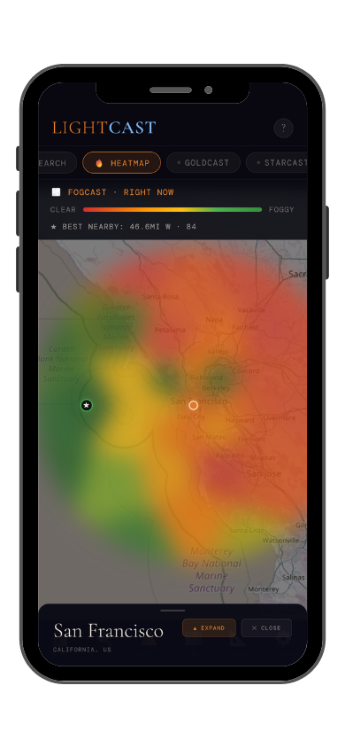
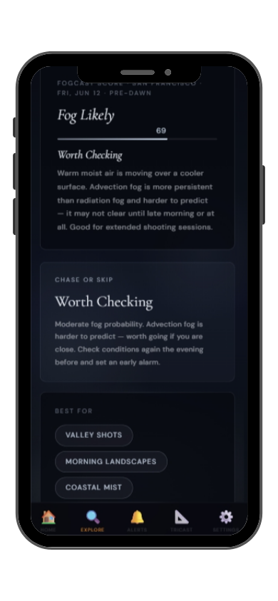
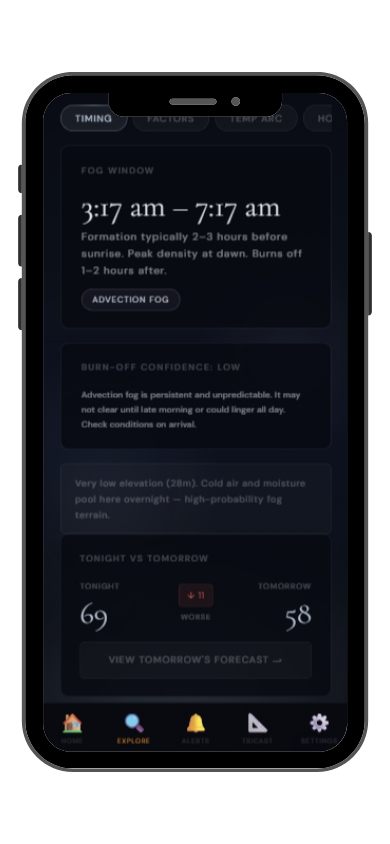
What the app shows you
Set a threshold and get a notifications when fog will form. Never check manually again.
Get LightCast Suite on iOS
Frequently asked
Can I check FogCast on the website?
This page shows a preview of current conditions, including humidity, wind, temperature, and dew point. The full FogCast score, 7-day outlook, push notifications, and best shooting windows are available exclusively in the LightCast app for iOS.
Is FogCast free?
The current conditions preview on this page is free, no account needed. The full FogCast tool is in the LightCast Suite iOS app, which includes a 7-day free trial. After the trial it's $2.99/month, cancel anytime in the App Store.
Why use FogCast instead of checking humidity?
Humidity alone doesn't tell you whether photogenic fog is likely. High humidity with strong wind produces no fog at all. FogCast combines dew point depression, wind speed, overnight sky clarity, temperature trend, and visibility into a single score built specifically for fog photography planning.
What is FogCast's scoring scale?
FogCast scores fog conditions from 0 to 100. A score of 75 or above indicates dense fog is expected. 55 to 74 means fog is likely and worth chasing. 35 to 54 suggests patchy mist is possible. Below 35, conditions are unlikely to produce photogenic fog. The full score is available in the LightCast app.