What the app shows you
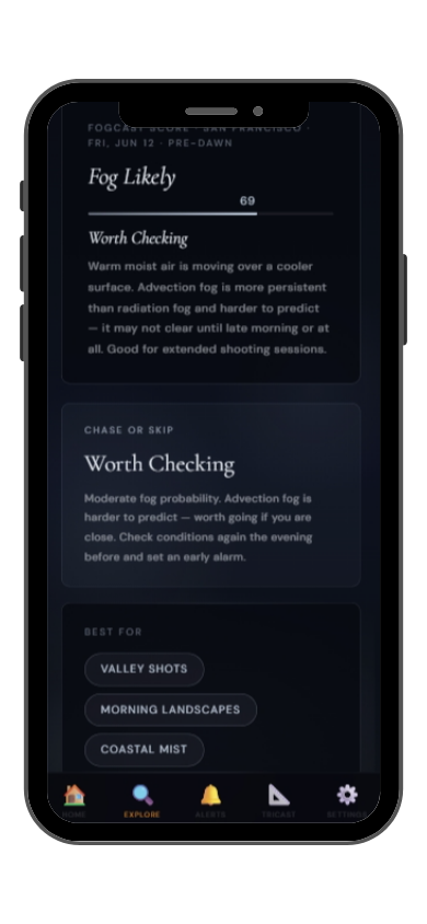

Full FogCast score, fog type, chase-or-skip verdict, and 10-day outlook — all in the app.
Get LightCast Suite on iOS
Know before you drive: FogCast checks the conditions that produce photogenic fog
Get more than a snapshot of current conditions. The LightCast app unlocks everything to plan ahead
Humidity alone isn't enough. Wind alone isn't enough. Cloud cover alone isn't enough. Photogenic valley fog requires several conditions to line up at once, and most weather apps don't read them together.
Set a FogCast threshold once. The app will alert you when conditions at your saved locations look promising, so you're not manually checking at 4am.

Don't waste a sunrise drive. Check FogCast before you leave.
Download on the App StoreCraggy Gardens sits at 1,830 meters along the Blue Ridge Parkway north of Asheville, a high bald ridgeline covered in ancient Catawba rhododendron that is famous for its June bloom. But the fog photography potential at Craggy Gardens extends throughout the year — the ridge sits directly in the path of orographic fog that forms when moist air from the southeast is pushed upward over the Appalachian crest, and the gardens are in cloud or fog more often than not from spring through autumn.
The Craggy Pinnacle trail and the Craggy Gardens Picnic Area trail system put photographers on the exposed bald ridges where fog drifts through the wind-sculpted rhododendron and heath. The Pinnacle at 1,863 meters is above the fog on some mornings and enveloped on others, and the transition as fog moves through is extraordinarily dynamic. June rhododendron bloom combined with fog is the single most sought-after photographic condition here. September and October are also excellent as fog combines with fall color in the ridge forests below.
Craggy Gardens fog is predominantly orographic — moist southeasterly flow is lifted over the Blue Ridge crest and condenses at ridge level. This fog moves and changes constantly rather than sitting stationary. Monitor 850mb temperature and moisture from the southeast: when moist, mild air is flowing from the Atlantic at low levels and the ridge temperature is 5–10°C below the dew point at that level, fog will be present at Craggy throughout the morning.