What the app shows you
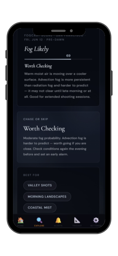
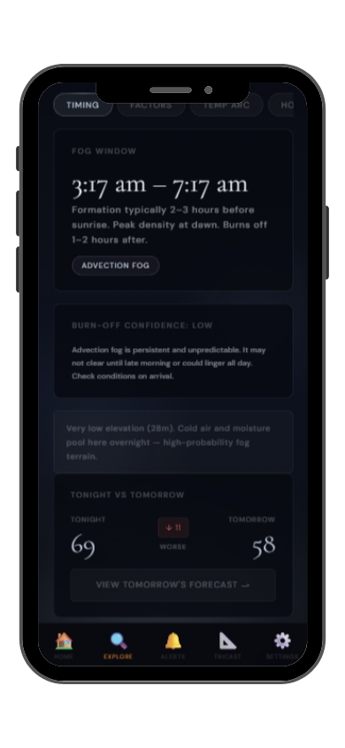
Full FogCast score, fog type, chase-or-skip verdict, and 10-day outlook — all in the app.
Get LightCast Suite on iOS
Know before you drive: FogCast checks the conditions that produce photogenic fog
Get more than a snapshot of current conditions. The LightCast app unlocks everything to plan ahead
Humidity alone isn't enough. Wind alone isn't enough. Cloud cover alone isn't enough. Photogenic valley fog requires several conditions to line up at once, and most weather apps don't read them together.
Set a FogCast threshold once. The app will alert you when conditions at your saved locations look promising, so you're not manually checking at 4am.

Don't waste a sunrise drive. Check FogCast before you leave.
Download on the App StoreGrand Teton National Park combines one of the most dramatic mountain ranges in North America with the flat Jackson Hole valley floor, and the contrast between the two creates the conditions for spectacular morning fog. Cold air drains off the Tetons overnight and pools in the valley, and when humidity is sufficient, dense radiation fog fills Jackson Hole while the peaks above remain clear in the early morning sky.
Oxbow Bend on the Snake River is the signature fog photography location: on foggy mornings the river curves through the mist with the Teton range reflected in the still water. Schwabacher Landing offers a similar composition with direct views of the Cathedral Group above the fog. The Antelope Flats road provides wide landscape angles with the Tetons as a backdrop to the fog-filled sagebrush flats.
Fall is the best season, from September through October, when overnight temperatures drop sharply and the aspen foliage adds color to the fog compositions. The window between first light and 9am is the most productive. Jackson Hole at roughly 2,000 meters elevation means overnight temperatures can drop significantly even in early fall, increasing radiation fog probability.