What the app shows you
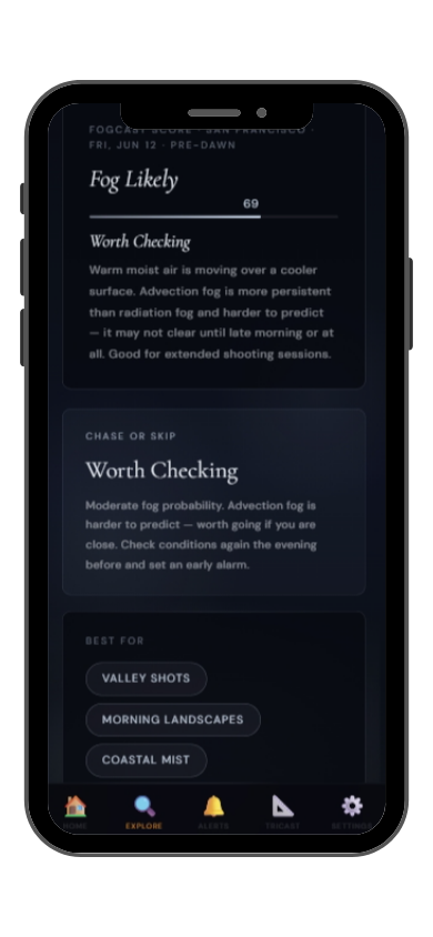

Full FogCast score, fog type, chase-or-skip verdict, and 10-day outlook — all in the app.
Get LightCast Suite on iOS
Know before you drive: FogCast checks the conditions that produce photogenic fog
Get more than a snapshot of current conditions. The LightCast app unlocks everything to plan ahead
Humidity alone isn't enough. Wind alone isn't enough. Cloud cover alone isn't enough. Photogenic valley fog requires several conditions to line up at once, and most weather apps don't read them together.
Set a FogCast threshold once. The app will alert you when conditions at your saved locations look promising, so you're not manually checking at 4am.

Don't waste a sunrise drive. Check FogCast before you leave.
Download on the App StoreHurricane Ridge in Olympic National Park sits at 1,594 meters above the Strait of Juan de Fuca and the Elwha River valley, giving photographers a high vantage point above the lowland fog systems that frequently fill the Olympic Peninsula below. When the valleys and strait are fogged in and Hurricane Ridge is clear, the result is one of the most spectacular above-fog panoramas in the Pacific Northwest — a sea of white stretching to the horizon with the Olympic peaks rising above it.
The Hurricane Ridge Visitor Center parking area and the meadow trails give broad south-facing views over the fog-filled valleys. The road to Obstruction Point, when open, extends the above-fog ridgeline perspective for miles. Looking north toward the strait, the fog often layers in bands between the ridges. September and October are the most reliable months for low valley fog with a clear ridge, before winter snowfall and storms close access. Early morning is essential — the fog burns off quickly once the sun clears the eastern peaks.
Hurricane Ridge fog photography requires fog in the valleys below while the ridge stays above the inversion layer. This happens when a high pressure system builds overnight, allowing cold air to pool in the valley floors while the ridge sits in clear, calm air above. Check valley fog reports for Port Angeles and the Elwha valley — if both are reporting dense fog with calm winds and a clear sky above 1,000 meters, Hurricane Ridge will be above it all at dawn.