What the app shows you
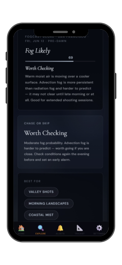

Full FogCast score, fog type, chase-or-skip verdict, and 10-day outlook — all in the app.
Get LightCast Suite on iOS
Know before you drive: FogCast checks the conditions that produce photogenic fog
Get more than a snapshot of current conditions. The LightCast app unlocks everything to plan ahead
Humidity alone isn't enough. Wind alone isn't enough. Cloud cover alone isn't enough. Photogenic valley fog requires several conditions to line up at once, and most weather apps don't read them together.
Set a FogCast threshold once. The app will alert you when conditions at your saved locations look promising, so you're not manually checking at 4am.

Don't waste a sunrise drive. Check FogCast before you leave.
Download on the App StoreLooking Glass Rock is a massive plutonic dome rising 390 meters above the surrounding Pisgah National Forest near Brevard, North Carolina. The smooth, curved granite face — polished by glacial meltwater and named for the way ice reflects light in winter — is one of the largest exposed rock faces in the eastern US. The forest surrounding the rock holds moisture from the Davidson River and Transylvania County's extraordinary rainfall, producing fog conditions that dramatically transform the rock's scale and relationship to the forested landscape.
The most powerful fog photography of Looking Glass Rock is from the Forest Road 475 pullouts and trails on the north side, where the full face of the dome is visible across the valley. When fog fills the Davidson River valley to 200–300 meters and the summit of the dome rises above it, the scale becomes surreal — a whale-back of gray granite emerging from a white sea. The Looking Glass Rock trail summit gives views over the forest fog from above. October and November are the peak months, with cold nights producing reliable valley fog and autumn leaves on the forest slopes adding color to the compositions.
Looking Glass Rock valley fog is radiation fog driven by cold air pooling in the Davidson River valley bottom. Transylvania County is one of the rainiest regions in the eastern US, so the atmospheric moisture base is almost always high enough for fog given sufficient cooling. A calm, clear night with temperatures dropping below 8°C in the valley produces fog by pre-dawn. The fog typically persists until 9 to 10am before solar heating on the dome face generates enough turbulence to mix the valley air.