What the app shows you
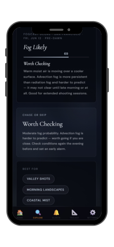
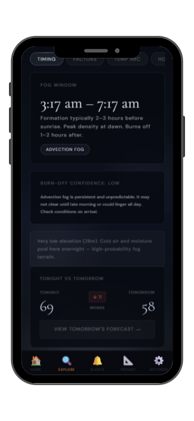
Full FogCast score, fog type, chase-or-skip verdict, and 10-day outlook — all in the app.
Get LightCast Suite on iOS
Know before you drive: FogCast checks the conditions that produce photogenic fog
Get more than a snapshot of current conditions. The LightCast app unlocks everything to plan ahead
Humidity alone isn't enough. Wind alone isn't enough. Cloud cover alone isn't enough. Photogenic valley fog requires several conditions to line up at once, and most weather apps don't read them together.
Set a FogCast threshold once. The app will alert you when conditions at your saved locations look promising, so you're not manually checking at 4am.

Don't waste a sunrise drive. Check FogCast before you leave.
Download on the App StoreTorres del Paine National Park in Chilean Patagonia contains three granite towers rising 2,500 meters above the Patagonian steppe — arguably the most dramatic mountain landscape in the western hemisphere. The park's weather is famously violent and unpredictable, driven by the Roaring Forties winds crossing the Southern Ocean with nothing to slow them. But when the wind drops and fog settles, usually in the hours just before and after dawn on the rare calm mornings, Torres del Paine reveals a different face — still, soft, and transcendent.
Lake Nordenskjöld and Lake Pehoé give the classic Cuernos del Paine reflections through fog and low cloud. The Mirador Las Torres at the base of the towers — reached by a 4-hour hike — is the most iconic composition when low clouds wrap around the base of the granite spires. The Grey Glacier and the Grey Lake viewpoints are excellent when low cloud sits on the ice. October through early April is the summer access season; November and December often have the most dynamic cloud and fog conditions combined with long light hours.
Torres del Paine fog is predominantly orographic cloud formed when moist westerly air is lifted over the Andes and condenses at the level of the towers. It moves fast — a scene can go from clear to completely fogged in 10 minutes and back again in 30. The most photogenic condition is partial cloud at tower level — some towers clear, others obscured, light streaming through breaks. Watch the wind: if sustained westerlies drop below 20 km/h at Lago Grey level by sunset, the following dawn may be calm enough for lake reflections and low mist.