 Denver, CO
Denver
Photography Conditions
Sunset · Astrophotography · Drone Flight · Pre-loaded for Denver
The iconic Denver shot. The red sandstone formations frame the city skyline to the east at golden hour — shoot from above the amphitheatre looking northeast. Light goes amber on the rocks about 30 minutes before sunset. Drone rules are strict in the park; check Dronecast and local restrictions before flying.
Check tonight's sunset →Flat water with the Front Range behind it. Best at sunrise when the mountains are lit from the east. In summer, Milky Way rises over the mountains from here — one of the few spots near the city where you get dark enough skies for a recognizable core shot with skyline foreground.
Check conditions →World-class dark sky within driving distance. The alpine meadows at Trail Ridge Road sit above 12,000 ft — less atmosphere between you and the Milky Way. Core shots over Longs Peak are among the best in Colorado. Check Starcast: afternoon thunderstorms are common in summer, but skies often clear by midnight.
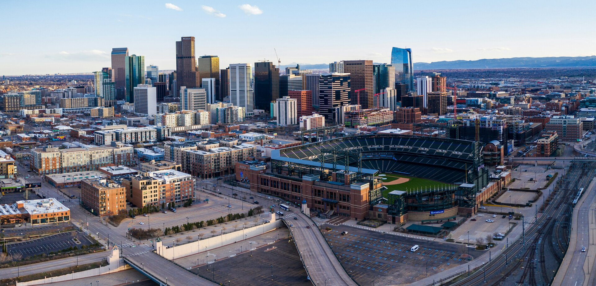
Check RMNP tonight →The South Platte River through downtown gives the city a photogenic waterfront most people overlook. Golden hour light reflecting off the water with Denver's skyline is a strong urban shot. The RiNo neighborhood murals are excellent in afternoon light. Less congested airspace than the mountains.
Check golden hour →| Location | Distance | Bortle | Best for | |
|---|---|---|---|---|
| Rocky Mountain National Park | 65 mi NW | 2–3 | World-class Milky Way, alpine | Starcast → |
| Great Sand Dunes NP | 230 mi SW | 2–3 | Core over dunes, iconic shot | Starcast → |
| Chatfield State Park | 20 mi S | 5–6 | Milky Way over Front Range | Starcast → |
| Eleven Mile State Park | 90 mi SW | 3–4 | Dark reservoir reflections | Starcast → |
- Post-snowstorm days produce exceptional clarity and Milky Way transparency
- Core rises in the southeast — visible from Chatfield and the foothills by May
- Golden hour at 7–7:30 PM, mountains lit pink in alpenglow
- Wind along the Front Range is strong: check Dronecast before flying near the foothills
- Core is up early — Milky Way season peaks at RMNP and Eleven Mile on new moon nights
- Afternoon thunderstorms are daily; skies often clear dramatically by sunset
- Red Rocks at golden hour: rocks go deep amber starting 45 min before sunset
- High altitude means less atmosphere — stars are noticeably crisper than at sea level
- Rocky Mountain aspen color peaks late September — golden hour in the foothills is extraordinary
- Milky Way fades in September; pivot to landscape and golden hour
- Post-front days offer best sky transparency of the year
- First snow on the peaks adds drama to skyline shots from Chatfield
- Denver sits at 5,280 ft — winter air is dry and transparent, excellent for stars
- Golden hour starts around 4:30 PM; low-angle sun on snow is intense
- Mountain roads close: check access before driving to dark sky sites
- Wind from the Rockies can be extreme — always check Dronecast near the foothills