 Los Angeles, CA
Los Angeles
Photography Conditions
Sunset · Astrophotography · Drone Flight · Pre-loaded for Los Angeles
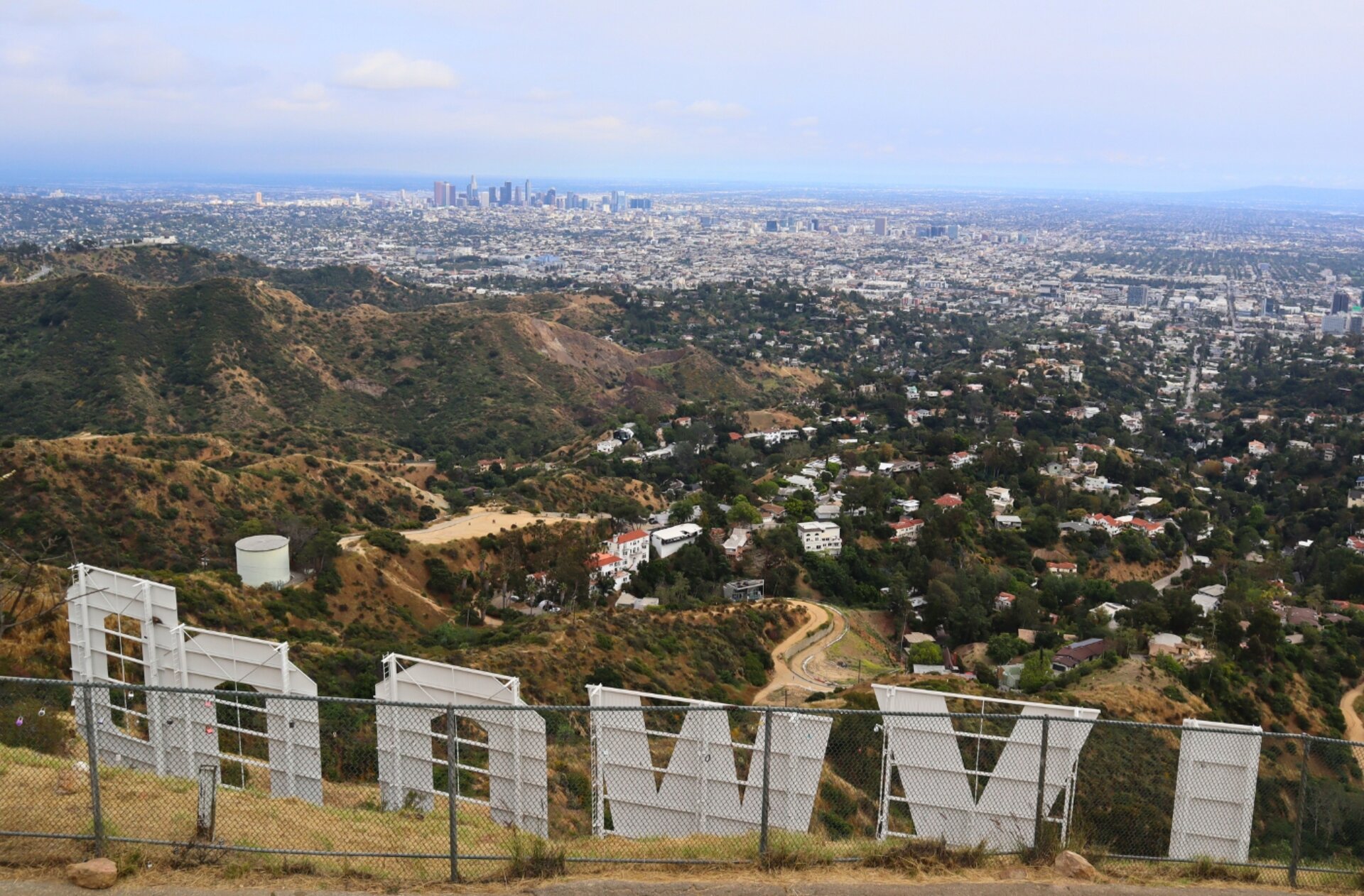
The definitive LA shot. The observatory at golden hour gives you the Hollywood sign, the downtown skyline, and the basin stretching to the Pacific — all from one elevated position. Arrive early: parking fills by 4 PM on clear evenings. The best angle faces southwest with the observatory dome as foreground.
Check tonight's sunset →El Matador's sea stacks and caves create dramatic foreground for Pacific sunsets. The sun sets directly over the water from late spring through fall. Drone regulations vary by beach section — check Dronecast for the specific coordinates before flying.
Check Malibu conditions →The closest genuinely dark sky from LA and one of the most photogenic in the country. Joshua trees as silhouettes against the Milky Way core is an iconic shot. The park sits at 4,000+ ft elevation. Spring and fall visits avoid summer heat. Check Starcast: transparency and moon phase are decisive here.
Check Joshua Tree tonight →Point Dume headland gives you a cliff-top view of the coastline curving south toward Santa Monica. Sunrise from here catches the Santa Monica Mountains in early light. The sea caves below are accessible at low tide and make for dramatic wide-angle foreground. Less crowded than El Matador.
Check sunrise forecast →| Location | Distance | Bortle | Best for | |
|---|---|---|---|---|
| Joshua Tree National Park | 130 mi E | 3–4 | Iconic Milky Way over Joshua trees | Starcast → |
| Anza-Borrego Desert | 120 mi SE | 2–3 | Exceptional dark sky, desert | Starcast → |
| Palomar Mountain | 75 mi SE | 4–5 | Observatory dark sky zone | Starcast → |
| Mt. Pinos | 80 mi NW | 3–4 | High altitude, excellent transparency | Starcast → |
- Super bloom in Antelope Valley and Anza-Borrego: golden hour over wildflowers
- Marine layer burns off mid-morning — check Goldcast for afternoon clearing
- Milky Way core returns by April — Joshua Tree and Anza-Borrego are prime
- Drone regulations tighten near beaches in spring: check Dronecast
- June Gloom: marine layer suppresses sunset color June–July, often clears by August
- Desert dark sky is excellent — Joshua Tree is hot but skies are exceptional
- Malibu and Point Dume sunsets peak when marine layer breaks in late afternoon
- Humidity near zero in the desert: best transparency for astrophotography
- Santa Ana winds clear the basin for exceptional visibility and vivid sunset color
- Post-Santa Ana sunsets can score 90+ on Goldcast — watch for the wind alerts
- Golden hour at Griffith captures the basin in hazy amber light September–November
- Fire risk affects drone regulations: check for TFRs in Dronecast during fire season
- Winter storms clear to produce the best visibility of the year — downtown from Griffith is stunning
- Low sun angle means dramatic shadows on canyon walls at golden hour
- Snow on the San Gabriels with the basin below: rare but extraordinary
- Best star transparency of the year from desert dark sky sites