 Atlanta, Georgia
Atlanta
Photography Conditions
Sunset · Astrophotography · Drone Flight · Pre-loaded for Atlanta
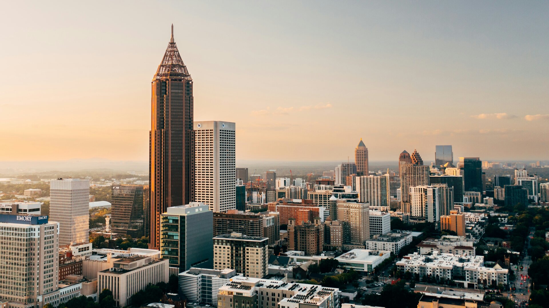
The most photographed skyline position in Atlanta. The Jackson Street overpass faces southwest directly toward the downtown cluster — One Atlantic Center, Bank of America Plaza, and the Westin Peachtree all visible in one compressed frame. At sunset the towers catch warm side light from the right. At sunrise the eastern sky behind you lights the facades. This position is known enough that you won't be alone at golden hour, but the sidewalk has room. Bring a wide and a telephoto — the compression options are different at each end.
Check tonight's sunset →The exposed granite dome gives one of the broadest panoramic views of the Atlanta metro — the city spreads across the entire western horizon from the summit. At sunset the skyline silhouettes against the western sky while the granite glows warm beneath your feet. The cable car or walk-up trail both reach the summit. Arrive 30 minutes before golden hour and face west. On exceptionally clear days after cold fronts the full metro is visible for 40+ km. The park has entry fees and hours — check before going.
Check Stone Mountain forecast →The rooftop of Ponce City Market sits directly on the BeltLine and faces north and west toward Midtown. At golden hour the Midtown cluster — including the AT&T building and the residential towers — catches warm light from the southwest while the BeltLine park activity continues below. The Skyline Park amusement area on the roof is ticketed, but the view from the accessible rooftop level is free. The Atlanta BeltLine below makes for an interesting foreground in wide shots at any hour.
Check Midtown conditions →The best dark sky accessible from Atlanta. The canyon rim at 550 m on the Cumberland Plateau gives Bortle 4–5 skies with dramatic sandstone canyon foreground. Milky Way core is visible April through September facing south. The canyon overlooks at the West Rim and Sitton's Gulch provide deep gorge views for foreground structure. Drive 100 km in about 90 minutes. Camping is available inside the park — plan for a full overnight rather than a quick trip out and back.
Check Cloudland Canyon tonight →| Location | Distance | Bortle | Best for | |
|---|---|---|---|---|
| Sweetwater Creek SP | 25 km west | 6–7 | Near-city escape, creek and ruins foreground | Starcast → |
| Cloudland Canyon SP | 100 km northwest | 4–5 | Canyon rim dark sky, plateau foreground | Starcast → |
| North GA Mountains (Vogel SP) | 130 km north | 3–4 | Blue Ridge dark sky, mountain lake foreground | Starcast → |
| Cohutta Wilderness | 150 km north | 3 | Best accessible dark sky from Atlanta metro | Starcast → |
- Dogwood and cherry blossom peak late March to mid-April — Piedmont Park and residential neighborhoods turn vivid pink and white
- Post-frontal evenings in March and April produce the most vivid Goldcast scores of the year
- Milky Way core returns in April; north Georgia mountain trips viable on new moon nights
- Afternoon storms begin building by May — check Goldcast as fronts clear quickly and can break into extraordinary golden light
- Sunset at 8:45 PM in late June — the longest golden hours of the year
- Daily afternoon thunderstorms are the main obstacle: storms typically clear by 7–8 PM, leaving clean golden light behind
- Post-storm windows can be extraordinary — washed air and dramatic cloud breaks over the skyline
- Milky Way peaks but humidity and atmospheric haze reduce transparency even at Cloudland Canyon
- Late October and November: humidity drops sharply, Goldcast scores peak across all Atlanta viewpoints
- Hardwood fall color in Piedmont Park and Grant Park peaks late October to mid-November
- Stone Mountain in fall: the granite dome glows warm at golden hour with colored forest below
- Cold front passages produce brilliant post-frontal skies — often the most vivid sunset color of the year
- Golden hour at 5:30 PM in December — the low winter sun hits the downtown towers at exceptional angles
- Atlanta rarely gets snow but ice events (January/February) transform the city 2–4 times per year — watch forecasts
- Post-frontal winter clarity gives the cleanest air of the year — best for distant skyline shots
- Jackson Street Bridge at blue hour in winter: city lights activate early and the sky holds color longer in dry winter air