 Phoenix, AZ
Phoenix
Photography Conditions
Sunset · Astrophotography · Drone Flight · Pre-loaded for Phoenix
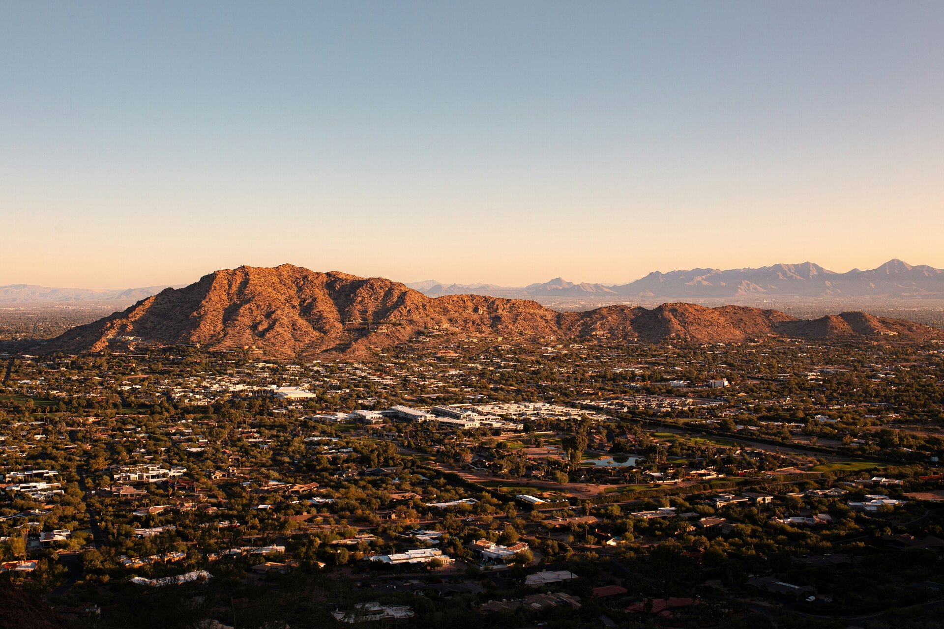
The highest point in Phoenix's city park system gives you the full metro spread to the north. At golden hour the Sonoran Desert foreground goes amber and the skyline lights up. Hieroglyphic Trail also offers saguaro-framed compositions. The park closes at sunset — check hours and arrive early enough to be positioned.
Check tonight's sunset →Hole in the Rock is a natural window formation that frames the rising sun in a perfect arch — exact alignment dates are in late winter. The red buttes photograph well at golden hour in every direction. The Desert Botanical Garden adjacent to the park adds saguaro foreground for telephoto work.
Check sunrise forecast →Sedona is an International Dark Sky Community. The red rock formations at Cathedral Rock and Bell Rock become extraordinary foreground for the Milky Way. Drive 30 minutes out of town toward Oak Creek Canyon for even darker skies. Monsoon season July–September builds afternoon clouds but often clears by midnight.
Check Sedona tonight →One of the darkest parks in the Southwest. The painted desert badlands provide layered foreground in every direction. No light pollution for 50 miles in any direction. Spring and fall visits avoid summer heat. The Milky Way over the petrified logs is a uniquely Arizona shot.
Check conditions →| Location | Distance | Bortle | Best for | |
|---|---|---|---|---|
| Sedona | 115 mi N | 4–5 | Red rocks + Milky Way | Starcast → |
| Prescott National Forest | 100 mi N | 4–5 | Pine forest, high elevation | Starcast → |
| Petrified Forest NP | 180 mi E | 2–3 | Exceptional dark sky, badlands | Starcast → |
| Kitt Peak area | 130 mi S | 2–3 | Observatory dark zone, desert | Starcast → |
- Best outdoor photography conditions of the year: cool, dry, clear
- Golden hour at 5:30 PM with long low-angle light across the Sonoran Desert
- Milky Way not visible but transparency is excellent for wide-field star work
- Saguaro blooms begin in late winter — green desert with clear sky is stunning
- Desert wildflower super bloom in March–April: golden hour over fields is extraordinary
- Milky Way core returns by April — Sedona and Prescott are the closest options
- Temperatures are perfect for all-night shoots before summer heat arrives
- Wind can be gusty in March and April: check Dronecast before flying
- Monsoon season: afternoon storms build daily, often clearing dramatically by evening
- Post-monsoon sunsets regularly score 80+ — the dusty air creates vivid color
- Milky Way core peaks but heat limits overnight shooting comfort
- Lightning photography during monsoon storms from South Mountain is iconic
- Monsoon ends in September: air clears and temperatures become ideal
- Best Milky Way transparency of the year before the core sets for winter
- Golden hour light on saguaros in October is some of the best in the US
- Drone conditions improve significantly after summer heat and monsoon end