 Salt Lake City, UT
Salt Lake City
Photography Conditions
Sunset · Astrophotography · Drone Flight · Pre-loaded for Salt Lake City
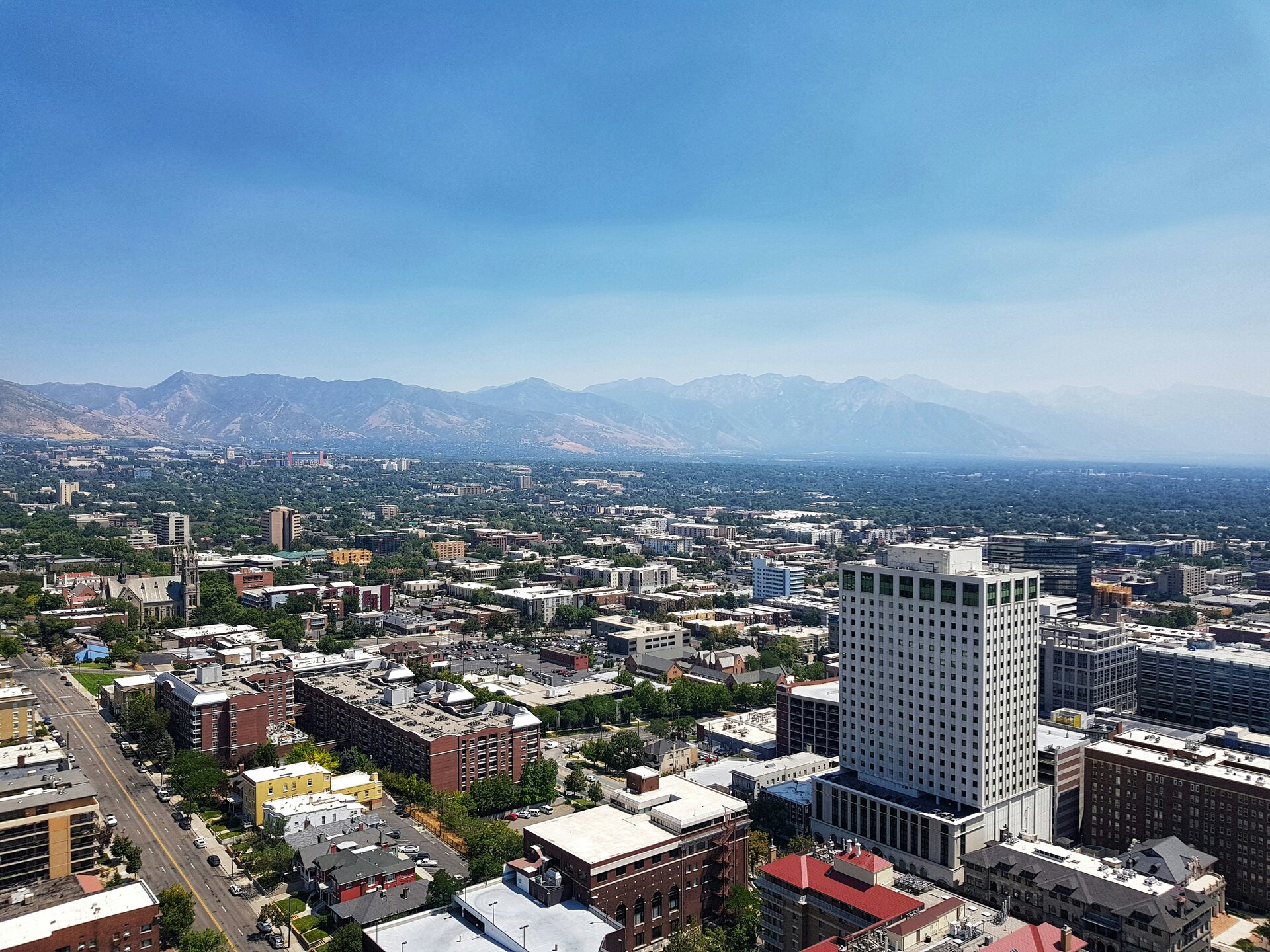
The 20-minute hike gives you the full SLC grid spread below, with the Wasatch mountains behind the city and the Great Salt Lake to the northwest. Golden hour light rakes across the valley and hits the Salt Lake Temple. Best in spring before summer haze and in fall when the Wasatch goes amber.
Check tonight's sunset →One of the most surreal photography locations in the US. The salt flat creates a perfect mirror surface after rain, producing Milky Way reflection shots that have been shared millions of times. No light pollution to the west at all. Bortle 3 in a location that's genuinely alien-looking. Best after late summer rains.
Check Salt Flats tonight →Antelope Island State Park gives you open water in every direction. The bison herds add foreground interest no other city has nearby. Sunset over the Stansbury Mountains across the lake is outstanding. Salt concentration turns the water pink during summer algae bloom — a uniquely Utah phenomenon.
Check conditions →The closest serious dark sky from SLC. Rush Valley is a high desert basin with minimal light pollution. Bortle 4–5 skies are achievable in under an hour. Clear western and southern horizons give you the full Milky Way arc in summer. Check Starcast: inversion layers can trap haze over the valleys.
Check Rush Valley tonight →| Location | Distance | Bortle | Best for | |
|---|---|---|---|---|
| Bonneville Salt Flats | 115 mi W | 3 | Reflection shots, alien landscape | Starcast → |
| Cedar Breaks NM | 250 mi S | 2 | World-class dark sky, amphitheatre | Starcast → |
| Rush Valley | 45 mi SW | 4–5 | Closest practical dark sky | Starcast → |
| Bryce Canyon NP | 270 mi S | 2 | Hoodoos + Milky Way, iconic | Starcast → |
- Wasatch snowpack peaks in April — golden hour on snow-capped peaks from Ensign is exceptional
- Milky Way returns in April — Rush Valley accessible and roads are clear
- Great Salt Lake water level and color change seasonally: check current conditions
- Wind in the valley can be strong in spring: check Dronecast before flying
- Salt flats are best after July–August monsoon rains fill the playa for reflection shots
- Milky Way peaks June–August: Bonneville Salt Flats, Cedar Breaks, Bryce Canyon
- Golden hour at 9 PM: long evenings allow for sunset + blue hour + stars in one session
- Inversion layers can trap valley haze: check transparency score in Starcast
- Wasatch fall color peaks late September to mid-October: golden hour from Ensign is extraordinary
- Antelope Island bison rut in October — wildlife + landscape opportunities
- Air clarity improves dramatically after summer: best city shots of the year
- Milky Way fades in September but transparency for stars is excellent
- SLC's notorious temperature inversions can create valley fog while peaks are clear above
- Drive above the inversion for exceptional star shooting and sunset views
- Golden hour on fresh Wasatch snowpack is outstanding — Ensign and City Creek trails
- Drone conditions vary wildly: inversions create odd wind patterns, always check Dronecast