 Vancouver, British Columbia
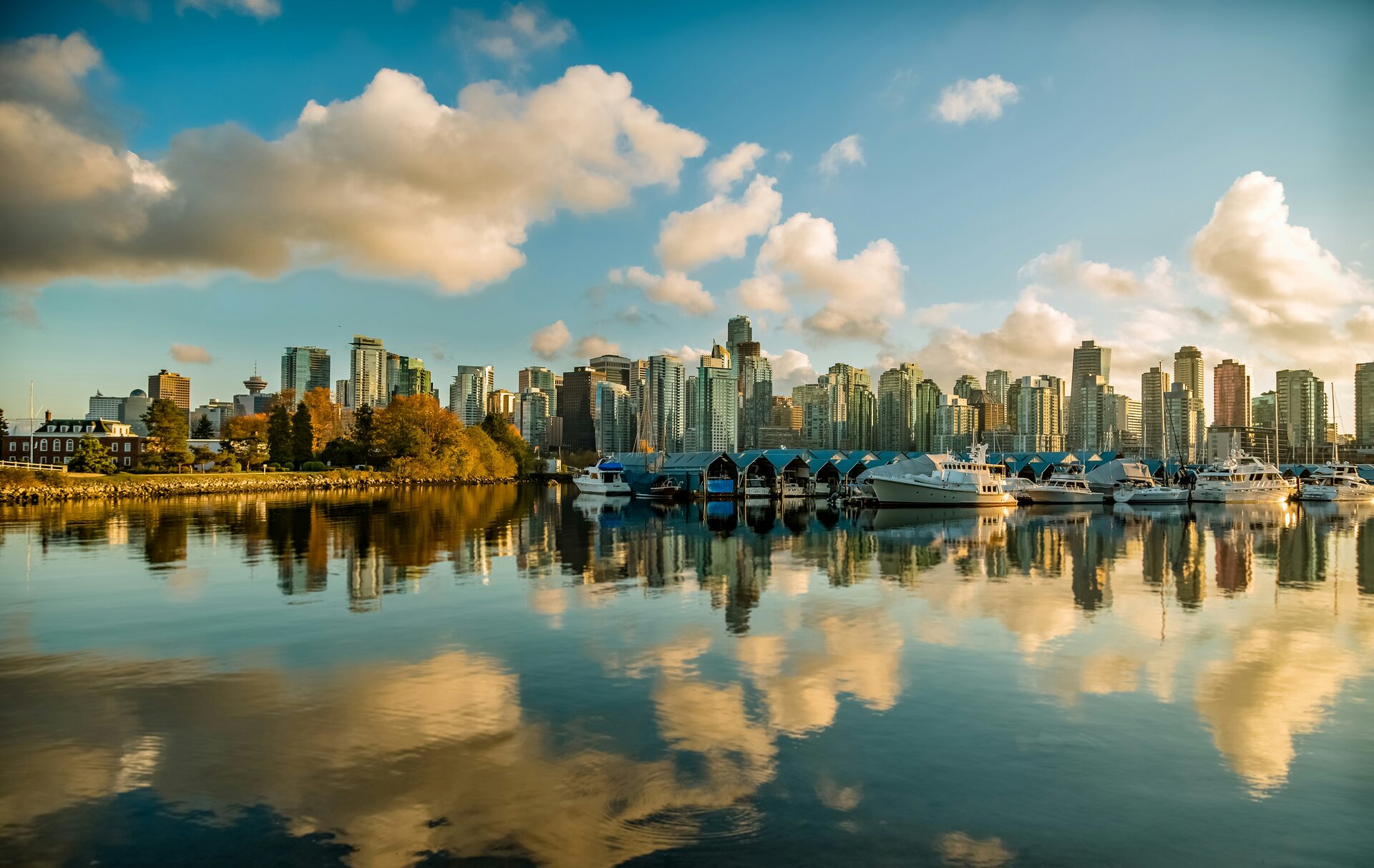
Vancouver
Photography Conditions
Sunset · Landscape · Astrophotography · Drone · Pre-loaded for Vancouver
The most accessible sunset position in the city. English Bay Beach faces directly west across the Georgia Strait — the sun sets over Vancouver Island in summer, dropping between open ocean and the North Shore mountain silhouette. The downtown skyline rises to the right, Stanley Park's treeline to the left. Sunset Beach (400 m south) gives a slightly different angle with less foot traffic. Arrive 30 minutes early in summer — the beach fills quickly on good-weather evenings. The foreshore is paved and flat, ideal for tripods.
Check tonight's sunset →Drive 30 minutes from downtown to the Cypress Mountain ski area and the Howe Sound viewpoint. From 900 m elevation, the full Vancouver cityscape, Georgia Strait, and Gulf Islands spread south below while the Black Tusk and Garibaldi peaks are visible to the north. At sunrise the first light catches the mountain snowfields while the city below is still in shadow — one of the finest urban-to-alpine photography compositions in North America. The lookout is accessible year-round by car; the road closes during snowstorms.
Check Cypress forecast →The Sea-to-Sky Highway (Highway 99) from West Vancouver to Squamish is one of the most photographed drives in Canada. The Stawamus Chief (700 m granite monolith) and the Howe Sound fjord are the signature compositions. Shannon Falls (335 m) is 5 minutes from the Chief and at its best in spring runoff or after rain. The Squamish Estuary at golden hour gives waterfowl and mountain reflection shots. Drive 60 km from Vancouver, park in Squamish, and explore on foot. Check Goldcast before the drive — marine cloud from Howe Sound can differ significantly from city conditions.
Check Squamish conditions →One of the finest dark sky locations in western Canada, 200 km east of Vancouver via Highway 1 and Highway 3. The Cascade Mountains provide Bortle 2–3 skies with high alpine meadows, glacial lakes, and subalpine fir forest as foreground. Lightning Lake and the Cascades Lookout are the prime positions. Milky Way core faces south April through September. The park has basic camping and is accessible by car. Check Starcast before the 2.5-hour drive — the rain shadow east of the Coast Mountains means Manning is often clear when Vancouver is clouded over.
Check Manning Park tonight →| Location | Distance | Bortle | Best for | |
|---|---|---|---|---|
| Squamish / Stawamus Chief | 60 km north | 4–5 | Granite monolith, fjord, waterfalls | Starcast → |
| Joffre Lakes PP | 160 km north | 3–4 | Turquoise glacial lakes, glacier foreground | Starcast → |
| Manning Provincial Park | 200 km east | 2–3 | Alpine meadows, rain shadow clear skies | Starcast → |
| Whistler / Garibaldi PP | 120 km north | 3–4 | Glacial lakes, volcanic peaks, alpine foreground | Starcast → |
- Pacific weather systems weaken through July — the most reliable clear skies of the year
- Golden hour at 9 PM in July: the low sun rakes across both the mountain snowfields and the Georgia Strait simultaneously — 90-minute sessions are possible
- Joffre Lakes wildflowers peak in July; Garibaldi Park snow bridges linger into August
- Manning Park Milky Way on new moon nights July–August: clearest skies of the season east of the mountains
- Larch trees in the Whistler/Garibaldi and Squamish highlands turn gold in late September and early October — one of BC's finest photography events
- Post-frontal windows between Pacific storms can give extraordinary clarity: snowcapped peaks with fall-coloured valleys below
- Rain and cloud return more frequently from October — patience required but rewards are significant
- Cypress Mountain lookout: snow on the peaks above, fall colour in the valleys below, city lights below that in one frame
- Heavy snowpack on the North Shore mountains from December: the Vancouver skyline with snow-covered peaks is exceptional on the 2–3 clear days per month
- Golden hour at 4:00 PM PST — brief but when it's clear, the low winter sun on fresh alpine snow is extraordinary quality light
- English Bay in winter storms: dramatic wave action and moody Pacific skies for seascape photography
- Patience strategy: check Goldcast daily, be ready to move fast when a clear window opens after a front passes
- Shannon Falls and other Sea-to-Sky waterfalls are at maximum flow April through June — peak waterfall season
- Cherry blossom in Vancouver's streets and parks peaks mid-March to early April
- Milky Way core returns in April; Manning Park trips viable on clear nights as Pacific weather eases
- June gives the first reliably clear evenings of the season — the start of the prime landscape photography window