 Auckland, New Zealand
Auckland
Photography Conditions
Sunset · Astrophotography · Drone Flight · Pre-loaded for Auckland
The best 360° view of Auckland from within the city. The volcanic cone summit looks north across the Waitemata Harbour toward the Hauraki Gulf, east over the eastern suburbs, west toward the Waitakere Ranges, and south over the Manukau Harbour. At sunset the western sky lights the entire panorama with the Sky Tower visible to the north. The obelisk monument gives foreground structure. Cornwall Park below has mature English trees that provide autumn colour in April and May. Free entry, accessible by car or 20-minute walk from the park gate.
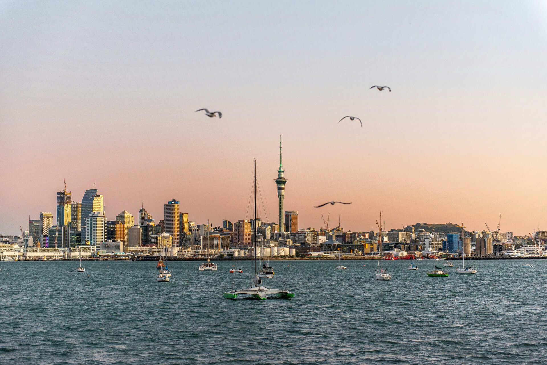
Check tonight's sunset →The Devonport waterfront on the North Shore faces directly south across the Waitemata Harbour toward the Auckland CBD skyline. At sunrise the CBD towers catch first eastern light with the harbour below in shadow — a clean city reflection shot without backlit issues. At sunset the sky behind Devonport's Victorian villas turns pink while the city lights across the water come on at blue hour. The Devonport ferry runs from Pier 2 downtown and takes 12 minutes. Mount Victoria (87 m) directly behind Devonport adds an elevated option.
Check Devonport forecast →Auckland's most dramatic coastal photography location. The black iron-sand beach faces west into the Tasman Sea, backed by the Waitakere Ranges. Lion Rock (101 m) rises from the beach at the centre of the bay and can be climbed for an elevated view at golden hour. At sunset the surf and black sand glow amber while the rock silhouettes against the western sky. After heavy rain the Kitekite Falls (30-minute walk inland) are at their best. The road from Auckland takes 45 minutes — allow time for conditions to evolve.
Check Piha forecast →The Coromandel's east coast faces the Pacific with minimal development east of the ranges. Cathedral Cove and Hahei Beach areas give Pacific Ocean horizon shots for Milky Way core compositions — the core rises in the north (southern hemisphere) October through April. The Coromandel Range itself (900 m) creates even darker skies on the western side above the tree ferns. Drive 100 km from Auckland via the Thames Coast road. Friday night departure from Auckland is fastest. Check Starcast before the drive — Auckland's weather systems don't always extend to the Coromandel.
Check Coromandel tonight →| Location | Distance | Bortle | Best for | |
|---|---|---|---|---|
| Hunua Ranges | 50 km southeast | 5–6 | Near-city escape, reservoir foreground | Starcast → |
| Northland (Mangawhai) | 100 km north | 4 | Pacific coast, ocean horizon | Starcast → |
| Coromandel (Hahei) | 100 km southeast | 3–4 | Pacific horizon, coastal rock formations | Starcast → |
| Waikato / Raglan coast | 120 km south | 3–4 | Tasman Sea horizon, surf coast foreground | Starcast → |
- March and April: summer humidity drops, post-frontal clearing is more reliable, light quality improves
- Cornwall Park and One Tree Hill have mature autumn colour through April and into May
- Milky Way still visible in March and April — Coromandel and Northland trips viable
- Fewer tourists than summer; volcanic cone viewpoints are manageable without early arrival
- Sunset around 5:15 PM NZST in June — brief but the low winter sun over the harbour is exceptional quality
- Cold front passages from the Southern Ocean bring the clearest air of the year post-front
- Milky Way core is below the horizon: full focus on golden hour and harbour blue hour photography
- Snow on the Hunua and Waitakere Ranges is rare but possible — watch conditions in July
- October: Milky Way core rises in the north again — Coromandel and Northland trips viable on new moon nights
- Kowhai trees bloom bright yellow through the harbour suburbs in August and September
- Tui birds feeding on kowhai are active and highly photogenic from August onward
- November: warm, relatively clear, with manageable crowds before Christmas
- Sunset at 8:40 PM NZDT in December — the longest golden hours of the year
- Milky Way core is at peak height in the north: Coromandel new moon nights are extraordinary
- Auckland summer is humid and hazy — Goldcast aerosol score worth checking before heading to viewpoints
- Piha and the west coast beaches are at their most dramatic with summer swell